The President's Park
(Give or Take a Few Acres)
Copyright © April 01, 2010 White House Historical Association. All rights reserved under international copyright conventions. No part of this article may be reproduced or utilized in any form or by any means, electronic or mechanical, including photocopying, recording, or by any information storage and retrieval system, without permission in writing from the publisher. Requests for reprint permissions should be addressed to books@whha.org

Pierre Charles L’Enfant’s 1791 “Plan of the City Intended for the Permanent Seat of the Government of the United States,” reproduced in 1887 as a facsimile by the U.S. Coast and Geodetic Survey Office. The President’s Park is labeled “I.” rising north from the Mall.
Library of CongressA recent magazine article described the garden of the White House, “known as the President’s Park,” as covering 82 acres and encompassing Lafayette Park and the Ellipse.1 Surrounded by a large fence, the White House indeed appears to be sited in spacious grounds, but the present White House grounds are only about 18 acres, less than a quarter of the original reservation. The original plans for both the president’s residence and its setting were much more ambitious. Included in Peter Charles L’Enfant’s 1791 concept for the new Federal City, the Executive Mansion was sited prominently on a rise as seen today from the north, and on the south built into a ridge, all surrounded by a tract of more than 80 acres. The designer labeled the reserve “President’s Park.” Today, however, most people perceive Lafayette Park, the White House Grounds, and the Ellipse as separate areas. All were—and are—part of the grounds designated by L’Enfant as the President’s Park.
L’Enfant’s original plans for the president’s grounds are more clearly defined. The boundaries stretched from H Street on the north to Tiber Creek (now Constitution Avenue) on the south, bordered on the east by Fifteenth Street, NW, and on the west by Seventeenth Street. The residence was to have been located at the northern end of these grounds, visible from the Capitol down Pennsylvania Avenue and for many miles from the south, as its sweeping vistas looked to the Potomac River and beyond. Wide terraces were to cross the entire tract south of the residence, roughly at E Street. To the north was to be a forecourt where five major avenues converged, an urban planning device familiar in front of palaces in European capitals.
The five spokelike streets were never extended all the way to the President’s House. A map drawn for one of the owners of the land upon which the President’s Park was located shows these avenues—extensions of Connecticut Avenue, Sixteenth Street, and New York Avenue—along with an early footprint of the “president’s palace.” Samuel Davidson, a Georgetown merchant, had purchased this land, known in part as the Port Royal Tract, in 1791 and 1792, anticipating profits from selling lots when the government acquired it. The boundary between Davidson’s acquisition and that of David Burns, whose family had owned their land for three generations, passed through what would become the President’s Park.

Detail of the first “Official Plan” for the city of Washington drawn in 1792, reflecting significant changes to the size and location of the foundations.
Library of CongressChanges in L’Enfant’s perfectly rectangular park began almost immediately, the first when city squares were created in the northernmost corners of the park. These appear already established in the 1792 engraving of the city plan. The next alteration of the President’s Park involved significant changes to the size and location of the presidential residence. L’Enfant’s concept of the building is unknown, lost when the ambitious but contentious Frenchman was fired after less than a year of service. But its footprint as laid out was about four times the size of the White House as built.
Faced with the loss of the city’s designer, and thus no house plans, George Washington held an architectural competition for both the Capitol and the President’s House. James Hoban, awarded the White House prize, presented a building more in the scale of a large country house in England or Ireland than the palace envisioned by L’Enfant. By this time the cellar for the larger building was already near completion. Hoban’s building was located on the northern end of the great chasm the cellars formed; President Washington himself drove the stakes siting the building to come, and thus removed the President’s House from the Pennsylvania Avenue axis or vista intended by L’Enfant.2
The park was further diminished by public buildings. Well before the President’s House was completed, two buildings were introduced to the grounds on President Washington’s orders, to end a dispute between himself and Congress over where offices for the public employees should be housed. The difference was, of course, over controlling the workers, but Washington’s idea that the executive needed the staff nearby won out. In time this decision, purely political, would bring the major incursion into the President’s Park. The Treasury Department Building was begun late in 1798, east of the President’s House. Erection of a similar structure to house other executive departments began on the west in 1799. Robert King’s 1798 map shows these two as yet incomplete buildings, both similar in size. Built close to the street, they were aligned with the squares to the north, at some distance from the residence. When the government moved from Philadelphia in 1800, the Treasury Department, with its sixty-five employees, was the first to arrive. It is certain that George Washington never imagined dwarfing the President’s House, as do the present Treasury on the east, and State, War and Navy Building on the west, built on the sites half a century after his time.

A map of President’s Square drawn in August 1798 by the government surveyor Robert King shows the President’s House positioned between two yet unfinished buildings: the Treasury Department on the east and a similar structure meant to house the other executive offices on the west, War, Navy, State, and the Post Office.
Library of CongressThe next important development in the history of the President’s Park occurred with the change of administration in 1801. John Adams lived in the house only a few months. His wife, Abigail, in an oft-quoted letter, described the house as habitable but noted that “we have not the least fence, yard or other convenience without.”3 Adams’s successor, Thomas Jefferson, lived in the White House for the next eight years and took an active interest in both the house and its grounds. Of particular relevance to the President’s Park are the wings he added to the residence and his decision to fence and develop the landscape of the grounds.
Jefferson first ordered a wooden rail and post fence in July 1801, which enclosed about nine acres of land. Later on, he replaced the wooden fence with stone walls and roughly doubled the size of the grounds. By 1808 the grounds (now nearly twenty acres) were enclosed around the President’s House. Early in his administration Jefferson began planning for the east and west wings, to connect the residence with the executive office buildings, as well as to conceal the homely “offices” needed for the house, such as wash facilities and a smokehouse. Construction began on these wings in 1805 but neither was completed as designed; indeed, their lengths were cut in half as built. An early nineteenth-century sketch, believed to be by Jefferson or the public architect Benjamin Henry Latrobe or both, shows the design for the wings, fencing, and plantings. This plan introduced the concept of separate White House Grounds within the President’s Park. The north side was the public entrance, and the south was reserved for private use and future pleasure gardens. This division of the grounds continues to this day.
Included in the sketch was a carriageway through the park, with a monumental entrance arch-of-triumph where Pennsylvania Avenue dead-ended at the President’s Park. This arch was actually built, a huge confection in stucco with sandstone trim and wooden gates, and doubtless was meant to compensate for loss of the grand climax the “palace” would have made to the avenue, had it been built. It stood until 1859, when it fell before the south expansion of the Treasury Building.
A decade later, after the White House and office buildings were burned during the British invasion of the city in August 1814, all were rebuilt; however, Congress authorized the erection of two additional structures to house the four executive departments. A separate building for the State Department rose to the north of the Treasury Department Building, on the east side of the grounds; the War and Navy Departments occupied the west side in two separate buildings.

Landscape plan for the White House Grounds apparently sketched by Thomas Jefferson, with Henry Latrobe’s penned suggestions between 1908-05, introduced the concept of separate White House Grounds within the President’s Park.
Library of CongressThe President’s Park served for several years after the War of 1812 as a construction station for the reconstruction of the White House. A sketch of Saint John’s Church made by Latrobe about 1816 depicts a horse and rider on a barren stretch between the church, completed on the north edge of the President’s Park in 1816, and the as yet unrepaired White House. The roadway may have been more of a country lane at this time. By the mid-1820s Pennsylvania Avenue had been cut across the President’s Park between Fifteenth and Seventeenth Streets. The insertion of this broad, rather roundabout extension of the capital’s main street created a strong physical and psychological separation of the White House grounds from the northern side of the President’s Park.
Only after completion of repairs following the fire of 1814 was the park to the north cleared, graded, and planted, orchard-like, with alternate slow-growing elms and fast-growing Virginia red cedar trees. Quick shade was provided by the cedars, while the elms, considered permanent, took their time growing up. Architect Charles Bulfinch devised the plan, allowing for streets to border the park. New north-south streets in the President’s Park appear on Robert King’s 1818 map of the city, as do streets on the south side of the two squares. However, these do not yet connect to a street immediately north of the White House, where Pennsylvania Avenue is today. The rest of the President’s Park appears intact on King’s map and in his field notes, as yet uninvaded by other new streets and avenues. By the time of President James Monroe’s public reception on New Year’s Day 1818, the first held in the rebuilt White House, the immediate grounds had been fenced in and wrought iron gates installed on the north side of the White House, along with two pairs of stone piers, the same in use today. These served to further distance the park to the north from the White House Grounds. After the visit of the Marquis de Lafayette in 1824 and 1825, the park on the north was named “Lafayette Park” and further severed from the White House Grounds. Formally, the park is still Lafayette Park; the term “Lafayette Square” refers to the houses facing the park.
In 1833, approximately the year President Andrew Jackson completed the landscaping of the grounds, the Treasury Department Building burned to its walls. This was the third fire that had ravaged it, the first in 1800 on upper floors in office papers, the second at the behest of the British in 1814. The third was as devastating as the second, resulting in demolition of the surviving brick walls and construction of a much larger “fireproof” structure in stone, lined with brick. This was the beginning of half a century of major expansion of the departmental buildings next to the White House.

The “Map of the City of Washington” by surveyor Robert King in 1818 showing new north-south streets bordering the President’s Park. A drover’s path was cut through the President’s Park on the South (I) but it is not shown here, nor is the high stone wall Jefferson built, more or less following the curve in the terrain, shown in the map.
Library of CongressRobert Mills was selected to design the new Treasury Department Building. His architecturally impressive colonnade along Fifteenth Street, reminiscent of neoclassical buildings contemporary to it in Europe, walled off the President’s Park. The Treasury Department Building would continue to grow, beginning in 1836, until it reached the present size in 1869. The old State Department Building was demolished to make way for the Treasury’s north wing. Considered to be the largest Greek Revival structure in the world, the completed Treasury Building ultimately covered 5 acres of the President’s Park. But this was not quite the end of the local expansion of the Treasury, which in 1919 erected an annex across Pennsylvania Avenue in the square occupying the northeast corner of the original President’s Park.
Following the Civil War, plans were made to replace the department buildings on the west side of the White House with one flamboyant building of great size. The result was the massive State, War and Navy Building, which rose between 1871 and 1888. The Second Empire–style building had a footprint similar to its counterpart on the east; it, too, walled off the President’s Park. The White House was now flanked by two buildings much taller and larger than itself. Late nineteenth-century efforts to expand it to match came to nothing and were silenced forever in the restoration and remodeling by Theodore Roosevelt in 1902.
Organization and ornamentation of the White House Grounds were piecemeal until 1850, when President Millard Fillmore engaged the noted landscape designer Andrew Jackson Downing—self-styled a “rural architect”—to develop plans for the grounds north and south of the White House as well as the Mall. This southernmost section of the park had been known for many years as the White Lot; explanations of the origins of the name vary.
It was marshy in wet seasons and had been a concern of inhabitants of the White House and the general area from the city’s very beginning. Downing called for filling it, raising the grade substantially, and laying out a circular parade formally planted with trees, all enhanced by footpaths and shady retreats. His death in a steamboat explosion in 1852, along with the growing political tensions that led to the Civil War, delayed the implementation of these plans. But Downing’s idea survived and influenced later developments of the President’s Park, in particular the section now known as the Ellipse, an oval substituted for his envisioned circle.

An isometrical view of the President’s House, the surrounding public buildings, and private residences drawn c. 1857. It anticipates new and expanded government buildings, some never to be realized, and omits such landmarks as the Jackson equestrian statue in Lafayette Park.
Library of CongressOn the north, the dedication in 1853 of Clark Mills’s equestrian statue of Andrew Jackson in Lafayette Park occasioned the installation of cast-iron fencing and new plantings. The unnamed thoroughfares on the west and east became Jackson Place and Madison Place.4 In 1891 a statue honoring Lafayette’s service in the American Revolution was unveiled on the southeast, the first of four significant bronze sculptures on the corners of the park.
The statues and subsequent landscape designs further defined the 7-acre Lafayette Park as a separate entity. Efforts to improve the President’s Park gained impetus after the Civil War, when, in the late 1860s, a plan to build a new president’s residence were abandoned. East Executive Avenue was cut through between the Treasury Building and the White House in 1866, and in 1871 West Executive Avenue was opened, linking for the first time the north and south parts of the President’s Park. Directing these changes was General Orville Babcock, aide-de-camp to General Ulysses S. Grant during the Civil War and a close friend who became private secretary when Grant became president. Babcock was an engineer with an interest in landscape, and Grant was quite comfortable with the fact that maintaining the White House had been placed under the Army Corps of Engineers. Babcock was given free hand. One of his many projects at the White House was demolishing Jefferson’s high stone wall on the south. Babcock, who made extensive improvements to city parks and streets as well, thus enlarged the White House Grounds to the south. East and West Executive Avenues, now completed, were extended into the grounds south of the White House, forming a semicircle. The street rounding the circle became South Executive Avenue.
The land south of the White House Grounds, the White Lot beyond Babcock’s new iron fence, was being filled by wagon- and cartload of topsoil, but it remained unfinished when Rutherford B. Hayes became president in 1877. A quarter-century after its design by Downing, the circular parade became a 17-acre “ellipse,” believed to be the largest in the world.5 This section of the President’s Park was laid out from 1877 to 1880 by the Army Corps of Engineers, primarily under the direction of Lieutenant Colonel Thomas Lincoln Casey. His annual reports document the use and adaptation of the Downing design and the final filling of the White Lot using soil excavated from the cellars of the State, War and Navy Building then rising. In the collections of the Library of Congress is a map probably used as a plan to develop the Ellipse.6 The circular roadway bordering the Ellipse became tangential to South Executive Avenue. No new roadways were cut into the President’s Park except for access to the Ellipse, but the development of this area as an integral unit also divided presidential parkland. The landscaping of the Ellipse and the eventual cutting through of E Street increased the separation of the southern portion of the park from the White House Grounds. The final partitioning of the President’s Park into the sections we now know was nearly complete.

Joseph Passonneau’s axonometric map of the city in the year 2000 shows further developments in the area of the President’s Park. To the right of the Ellipse the large single building is the 1928 Commerce Department; beyond it is the west end of the Federal Triangle complex, 1910–38. While the 19th-century Ellipse and executive buildings appear much the same as they have for a century, north of the White House, however, the large new government buildings of the 1960s and 1970s loom over the restored row houses of Lafayette Park.
Library of CongressMany of the twentieth-century changes in the President’s Park have resulted from changes in the roads, except for E Street, which already cut across the tract. A 1922 map shows E Street invading the area from the east but not yet the west.7 Security considerations during World War II necessitated the closing of West Executive Avenue to the public, because by then the executive offices had spilled over from the West Wing to the State, War and Navy Building, and access between the two was in the open air, across that street. The avenue was never reopened. East Executive Avenue was closed in 1987, also a security measure to better control approach to the White House from the east or everyday entrance. Pennsylvania Avenue was closed to vehicular access in 1995; E Street soon followed. The portion of the President’s Park below Lafayette Park and above E Street became, for all intents and purposes, a hard-to-access secured area demarcated by guardhouses, Jersey barriers, and bollards. Security efforts serve to emphasize the increased isolation of the central section of the President’s Park.
The executive departments occupying the old State, War and Navy Building gradually left for other locations; the vast beehive of offices was given over to the use of the White House so that this area was effectively returned to the use of the president, if not to parkland. The Treasury Department remains firmly in place in its original location. Each occupies about 5 acres of the park. The National Park Service was given jurisdiction over the President’s Park in 1933, and the Army Corps of Engineers’ nearly seventy years of authority ended. A brochure available at the White House Visitors’ Center in early 2008 includes a map and walking tours of the President’s Park. The name is used on Park Service literature as well as signs in the area, but it rarely appears in maps or guidebooks. And an informal survey reveals that even longtime residents of the city are not familiar with the term, nor do they perceive of the area by the name of the President’s Park.
What began as decisions by President Washington in the late eighteenth century was only the beginning of the partitioning of this large tract. The sections cut off the President’s Park and given other names are well known: the Ellipse, the White House Grounds, Lafayette Park, General William T. Sherman’s equestrian statue and its surrounding plaza, the grounds of the Treasury, and the Old State, War and Navy Building, now renamed the Eisenhower Executive Office Building. The larger context, the President’s Park, while it remains a legal preserve within the capital, has surrendered its own identity otherwise to its parts.
You Might Also Like
-
 Podcast
Palace of State: The Eisenhower Executive Office Building
Featuring John F.W. Rogers, Chairman of the White House Historical Association’s Board of Directors
-
 Collection
The Decatur House Slave Quarters
In 1821-1822, Susan Decatur requested the construction of a service wing. The first floor featured a large kitchen, dining room, and laundry; while the second floor contained four rooms designated as living quarters. By 1827, the service wing was being used as an urban slave quarters. Henry Clay brought enslaved individuals to Decatur House, starting a trend that was solidified by
-
 Podcast
White House Builder James Hoban’s Irish Roots
Featuring Laurie Grace, Chairman of the James Hoban Society of Ireland; Brother Christy O’Carroll, Congregation of Christian Brothers; Ciarán O’Connor, State Architect of Ireland; Merlo Kelly, Senior Architect, Lotts Architecture & Urbanism; Brian O’Connell, Director and Founder of O’Connell Mahon Architects and a contributor to the book James Hoban: Designer and Builder of the White House
-
 Podcast
St. John’s, the Church of the Presidents
Featuring Rev. Robert Fisher, Rector at St. John’s Church
-
 Podcast
James Hoban, Designer and Builder of the White House
Featuring Dr. Christopher Moran, Chairman, Co-Operation Ireland; Merlo Kelly, Design Fellow, University College Dublin, School of Architecture Planning and Environmental Policy; and Andrew McCarthy, Independent Historian and Scholar
-
 Collection
The Kennedy Rose Garden
It is hard to imagine that it was something as casual as a lunch conversation between a newly elected president and an amateur gardener that gave rise to one of our nation's most iconic outdoor spaces. In this collection, Rose Garden designer Rachel Lambert Mellon explains how the grounds were so thoughtfully transformed, while others detail the White House's diverse
-
 Collection
All Hallows' Eve Haunts & Traditions
Today, the celebration of Halloween conjures images of costumed trick-or-treaters, sweets, and jack-o'-lanterns; but there was a time when All Hallows' Eve focused more on the night's thinning boundary between this world and the next. Tales of ghosts and haunted places naturally bubble to the surface this time of year, and with such rich history radiating from its halls, there
-
 Collection
President Truman's Renovation
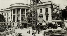
During the administration of President Harry S. Truman, the White House underwent a renovation and expansion so extensive, it changed the Executive Mansion more than the fire of 1814. The White House we know today is largely due to the renovation led by Truman. The construction took place between 1948 and 1952 and was a remarkable feat of engineering. National Park Service photographer
-
 Collection
White House Easter Egg Roll
Since 1878, American presidents and their families have celebrated Easter Monday by hosting an "egg roll" party. Held on the South Lawn, it is one of the oldest annual events in White House history. It has changed and evolved through the years and each First Family has put their stamp on the popular public event. From the roll's origins to today,
-
 Collection
White House in Bloom
The White House Grounds began as approximately 85 acres of land chosen by George Washington and was refined and cultivated by garden-loving President Thomas Jefferson. These shifting grounds around the Executive Mansion have seen retaining walls, green houses, vegetable gardens, and beautiful flowers. Changes to the landscape came in long intervals and evolved to fit the era and the needs of
-
 Collection
The President's Neighborhood
Since the White House was first occupied by President John Adams in 1800, influential people and organizations—or those who hoped to have influence—have bought property and built homes and offices along the streets surrounding the White House. For more than two centuries, this neighborhood has been the setting for political decision-making and diplomacy, social gatherings and protests, wartime expediencies and
-
 Collection
Tudor Place
Two grand houses were under construction in the young Federal City in 1816: one the President’s House, reconstructed after it was burned by the British in 1814, and the other Tudor Place, an elegant mansion rising on the heights above Georgetown. The connection between these two houses is more than temporal, as they were connected through lineage and politics for generations. Th
-

-

-

-

-

-

-

-

-

-

-

-

-

-

-

-

-

-

-

-

-

-

-

-

-

-

-

-

-

-

-

-

-

-

-

-

-

-

-

-

-

-

-

-

-

-

-

-

-

-


